So, What Exactly is Chang La?
Chang La is a high-altitude mountain pass in the Ladakh range, sitting at 17,590 feet (5,360 meters). It's the third highest motorable pass in the world (after Umling La and Khardung La). The pass lies on the road from Leh to Pangong Tso, about 130 kilometers from Leh.
The name "Chang La" means "Pass of the South" in Tibetan. But honestly? The name doesn't matter. What matters is that this pass stands between you and one of the most beautiful lakes on earth. And like any good guardian, it makes you work for the reward.
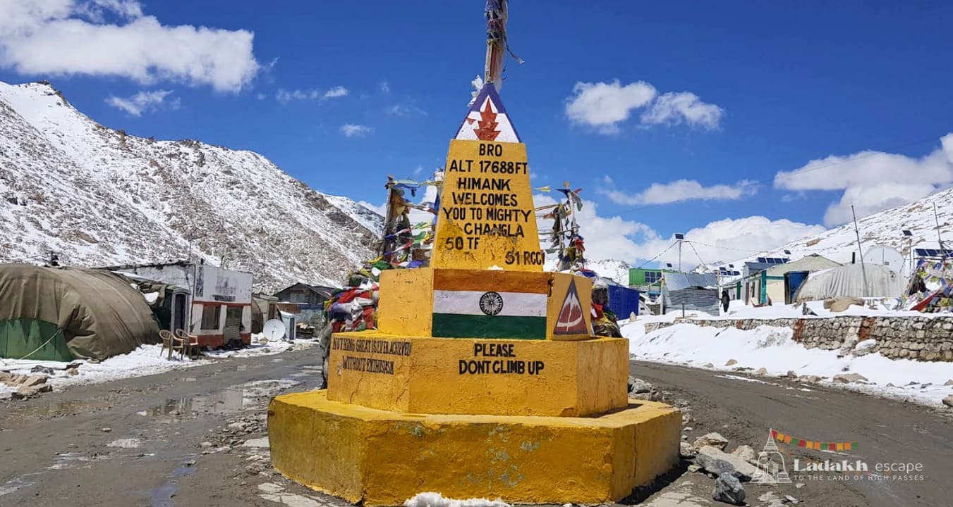
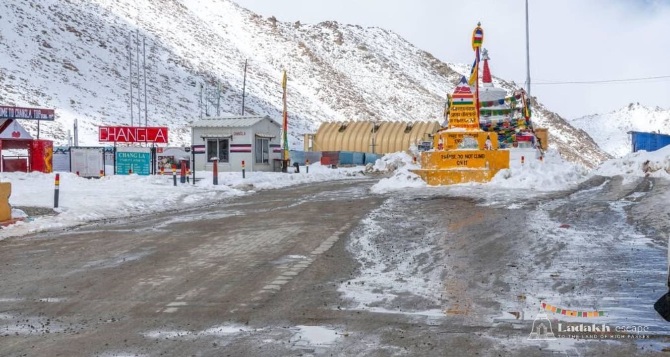
The pass is maintained by the Border Roads Organisation (BRO), the same heroes who keep Ladakh's roads alive. They have a sign at the top that proudly declares Chang La as the "World's Third Highest Motorable Pass." And when you're standing there, freezing and gasping, you'll believe every word of it.
Why Chang La is Different from Khardung La
Look, everyone talks about Khardung La. It's famous. It's on every bucket list. But Chang La has its own magic. Here's what makes it special:
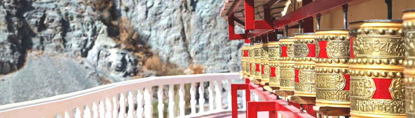
- The temple at the top. Unlike Khardung La, Chang La has a small Buddhist temple right at the summit. Monks live here. Prayer flags cover every surface. There's a sense of peace that Khardung La doesn't have.
- The army cafe. Free tea. Yes, free. The Indian Army has a small cafe at the top where they serve hot tea to travelers. No charge. Just kindness at 17,000 feet.
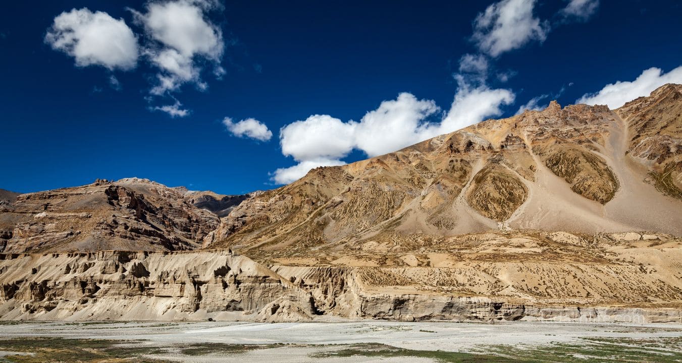
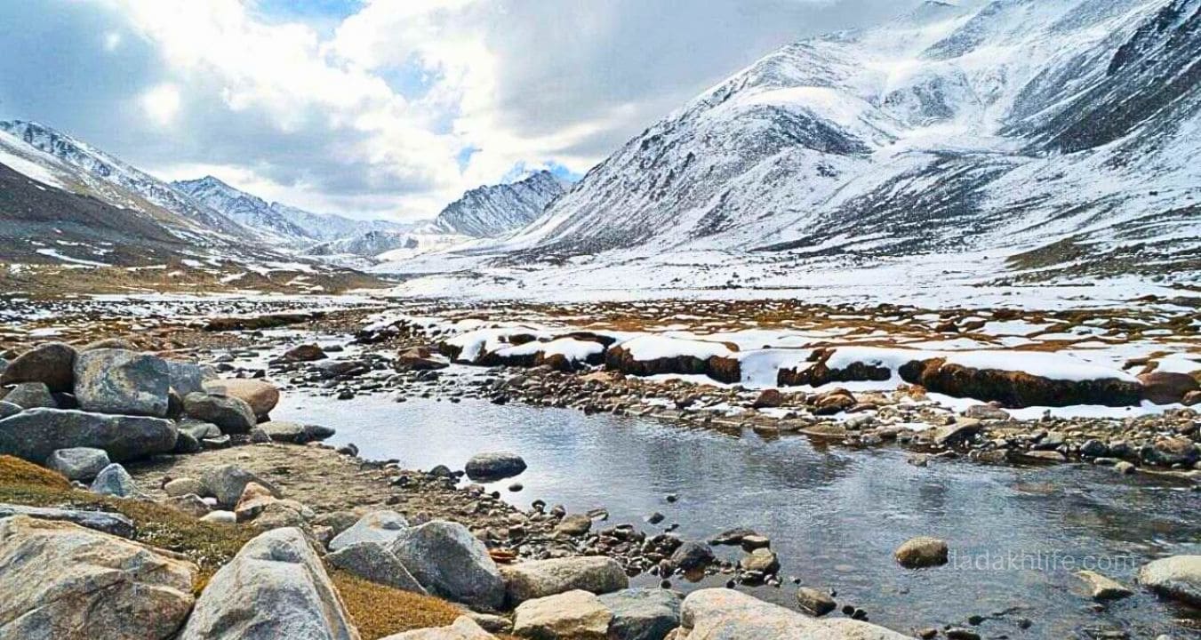
- The views of the Chang Chenmo range. The mountains visible from Chang La are stunning jagged, snow-covered, stretching to the horizon.
- The road to Pangong. The drive after Chang La, toward Pangong Tso, is one of the most beautiful in Ladakh. You'll understand why when you see it.
- Fewer crowds. Khardung La gets all the attention. Chang La is quieter. You might have the top to yourself on a good day.
The Chang La Experience (The Honest Version)
Let me walk you through what actually happens on a Chang La crossing. No filters. No fancy language.
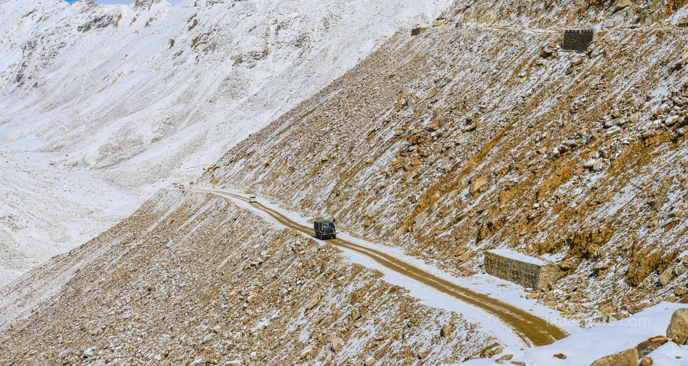
- Starting from Leh (11,500 ft): You're excited. Maybe a little nervous. The road to Chang La starts off easy paved, wide, following the Indus River.
- The first 70 kilometers: You pass through Karu, then turn toward Pangong. The valley opens up. The mountains get bigger. You start seeing signs for "Chang La 17,590 ft."
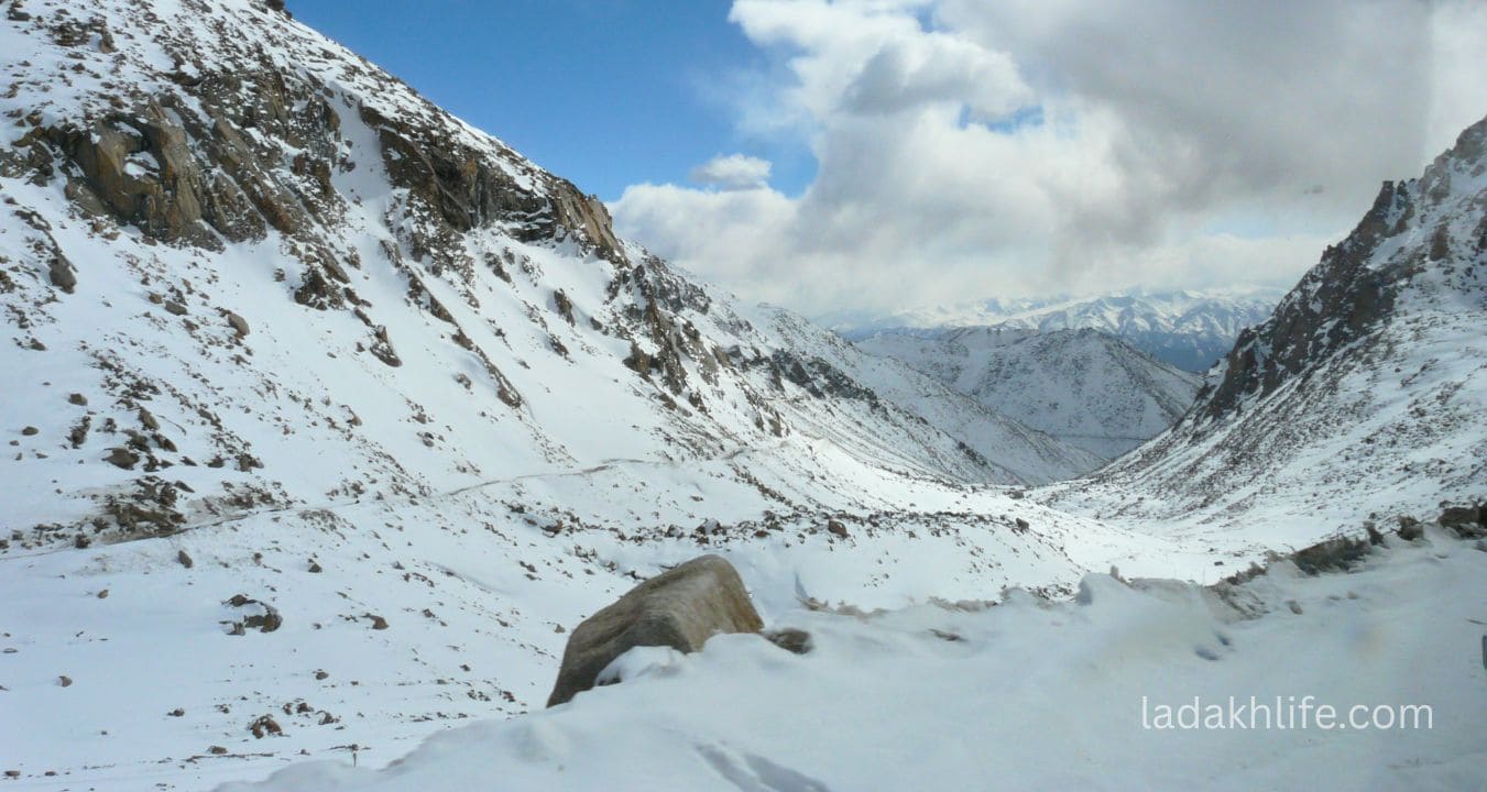
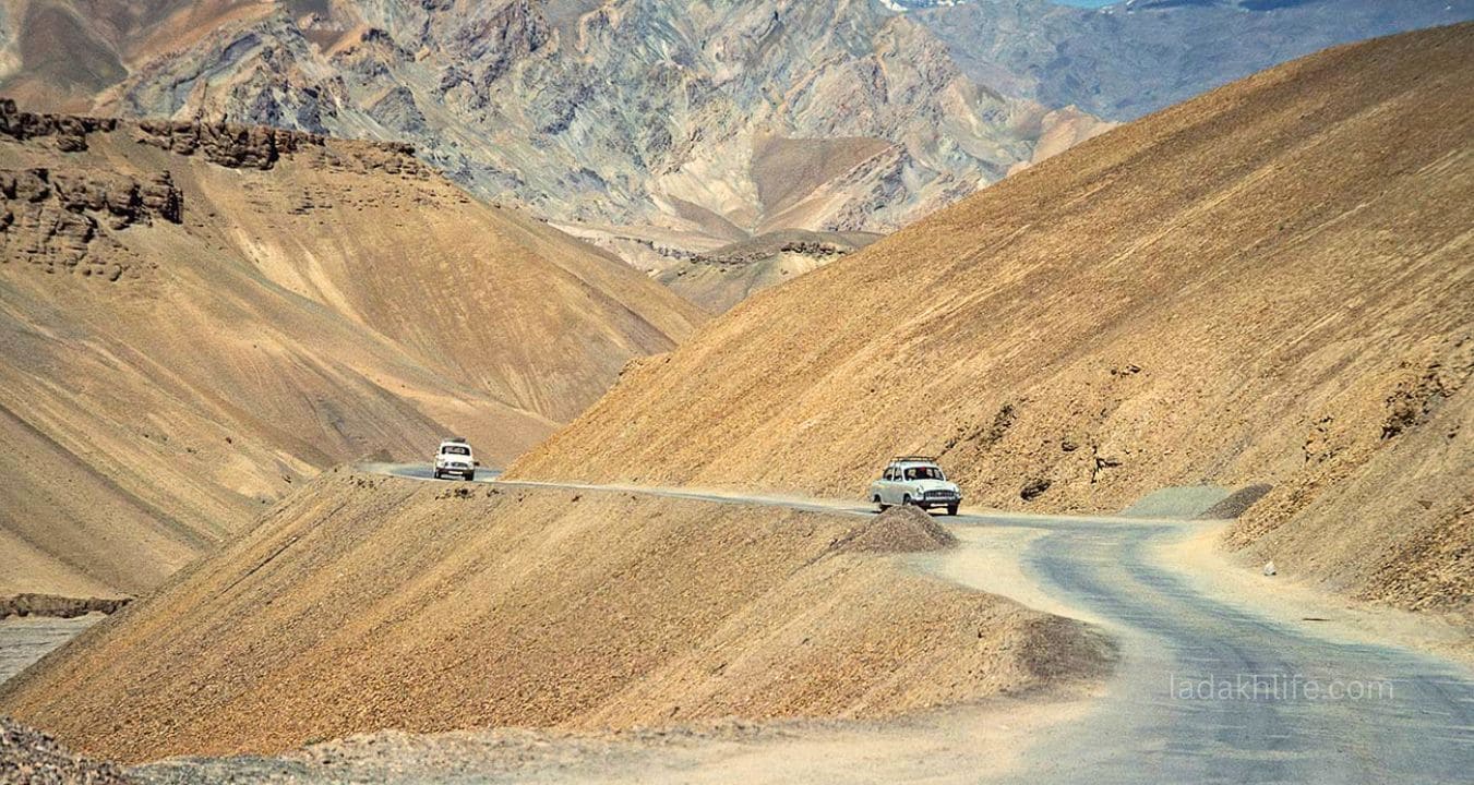
- The last 30 kilometers: This is where it gets real. The road starts climbing. Hairpin bends. The air thins. Your vehicle struggles. Your head starts to pound. You look at the altimeter on your phone and watch the numbers climb. 15,000. 16,000. 17,000.
- Reaching the top: You see the prayer flags. You see the temple. You park, step out, and the wind hits you. Your legs feel heavy. Your head is pounding. You take slow, deliberate steps. A soldier waves at you and points to the cafe. "Free chai," he says. Best words you've heard all day.
- At the top: You sip the chai. You walk around the temple. You take photos with the signboard. You stand at the edge and look out at the Chang Chenmo range peak after peak, white and grey, disappearing into the distance. You feel small. You feel alive.
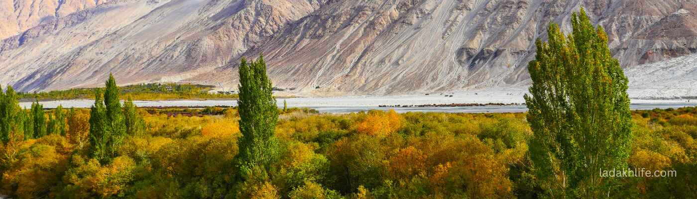
- The descent: You drive down toward Pangong, and suddenly the air feels thicker. Your headache fades. The landscape changes from barren moonland to green patches near Tangste. You pull over, look back at the pass, and think, "Pangong, here I come."
That's Chang La. Not as famous as its cousin. But just as unforgettable.
The Crown Jewels of Chang La (Don't Miss These)
1. The Temple A Little Bit of Peace at 17,590 Feet
Right at the summit of Chang La, there's a small Buddhist temple. It's nothing fancy a single room with a statue of Buddha, some thangkas on the walls, and the smell of butter lamps. But there's something about it. Maybe it's the location. Maybe it's the monks who live there, breathing thin air every day. Walk inside. Spin the prayer wheels. Sit for a moment. You'll feel something shift.
2. The Army Cafe Free Chai & Warm Smiles
This is my favorite thing about Chang La. The Indian Army has a small cafe at the top where they serve free tea to travelers. No charge. No expectations. Just soldiers making chai for cold, tired strangers. Sit inside. Warm your hands on the cup. Say thank you. And if you can, leave a donation they use the money to maintain the pass.
3. The Signboard World's Third Highest Motorable Pass
Yes, it's touristy. Yes, everyone takes the same photo. But take it anyway. Stand next to that board. Smile (or gasp for air both work). You've earned it. And unlike Khardung La, the claim on this board is still accurate.
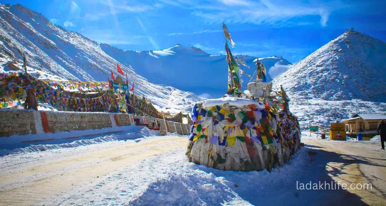
4. Prayer Flags Everywhere
The top of Chang La is covered in prayer flags thousands of them, in every color, fluttering wildly in the wind. The sound they make is like nothing else. A constant, gentle flapping that somehow feels like a prayer itself.
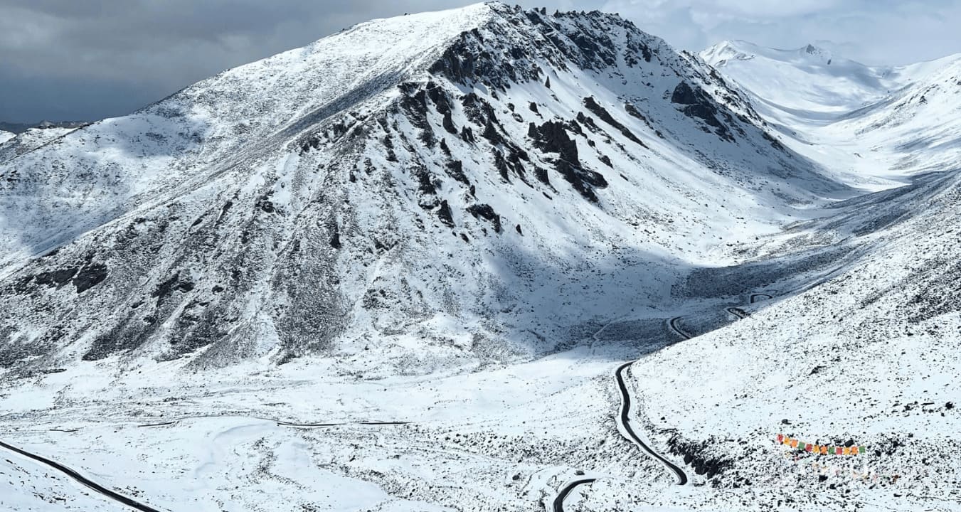
5. Views of the Chang Chenmo Range
On a clear day, the views from Chang La are staggering. The Chang Chenmo range stretches to the east, with peaks over 6,000 meters. The valleys below are barren and beautiful. Just stand there. Breathe (as much as you can). Take it in.
6. The Drive to Pangong After the Pass
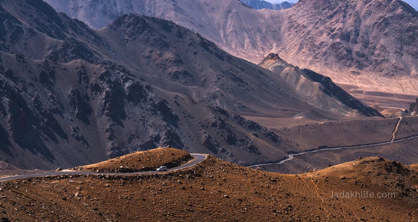
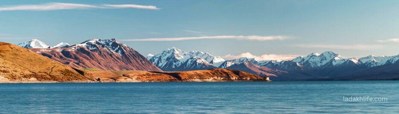
The descent from Chang La toward Pangong Tso is spectacular. The road winds down through valleys that change color with every turn brown, grey, green, gold. You'll pass tiny villages like Tangste, with their fields of barley and poplar trees. And then, after hours of driving, you'll see it the first glimpse of blue. Pangong. And you'll know it was all worth it.
Best Time to Visit Chang La
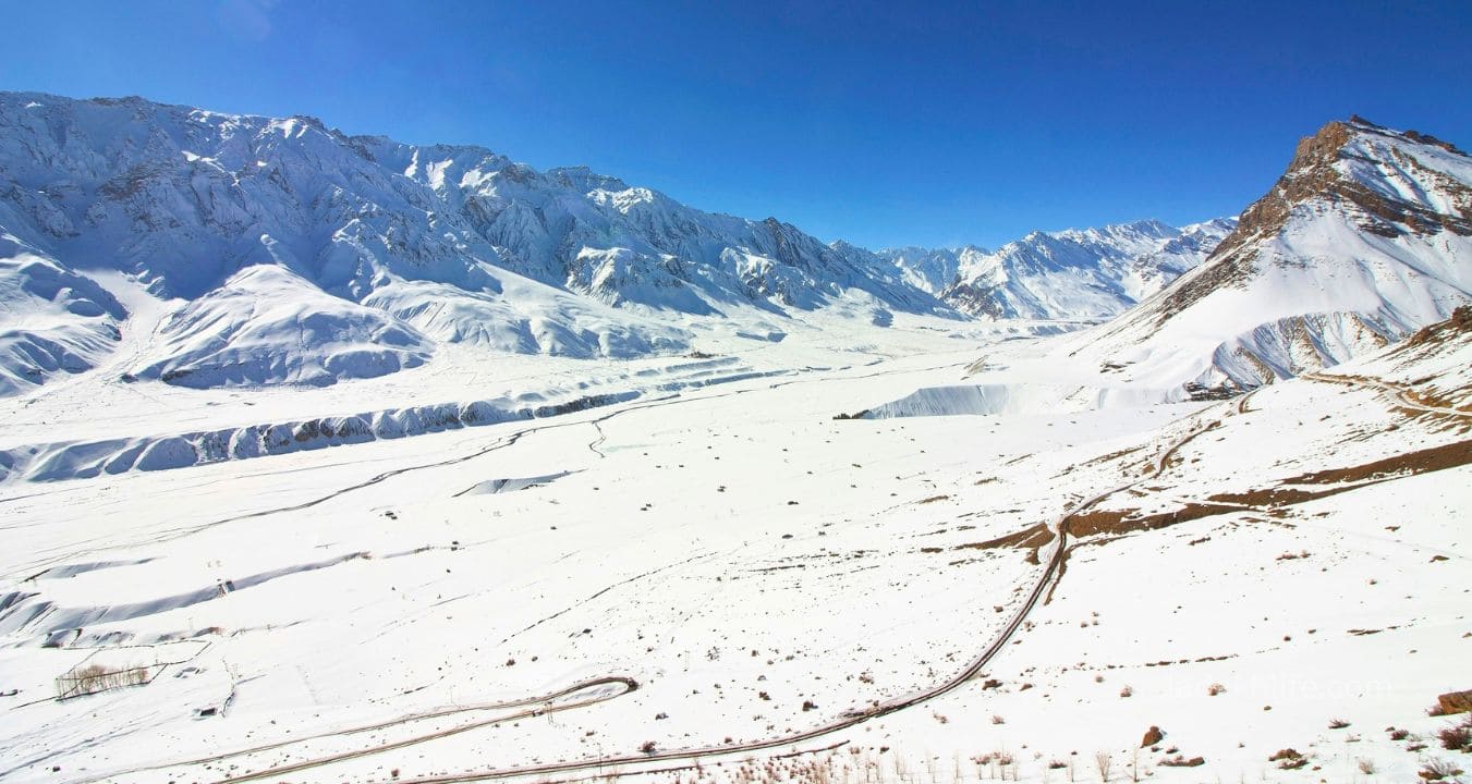
Chang La is not open year-round. Like most passes in Ladakh, it closes in winter.
June to September is the best window. July and August are the most reliable months the road is usually clear, the weather is as stable as it gets at 17,000 feet, and the pass is open most days. Daytime temperatures at the top are around -5°C to 5°C, with wind chill making it feel much colder.
May and September: Shoulder months. May can be tricky the pass sometimes opens late if there's still snow. September is beautiful clear skies, crisp air, fewer crowds but it's colder.
October to April: Forget it. The pass closes due to heavy snowfall. Do not attempt.
Pro tip: Start your journey from Leh early by 6 AM at the latest. Chang La is 130 kilometers from Leh, and you still have a long drive to Pangong after the pass. Leave early, enjoy the top, and reach Pangong before sunset.
Where to Stay Near Chang La
You cannot stay at Chang La. There are no hotels or homestays at the top. The nearest accommodations are in Leh (before the pass) or in the villages near Pangong Tso (after the pass).
In Leh: Every budget. Book in advance during peak season (June-August).
Near Pangong Tso: Homestays and camps in villages like Spangmik, Man, Merak, and Lukung. Staying near Pangong after crossing Chang La is the standard itinerary. Book ahead camps fill up fast in July-August.
No camping at the pass. It's too cold, too high, and not allowed.
How to Get to Chang La
Chang La is on the Leh to Pangong Tso road, about 130 kilometers from Leh. The drive takes 4-5 hours one way, depending on road conditions and stops.
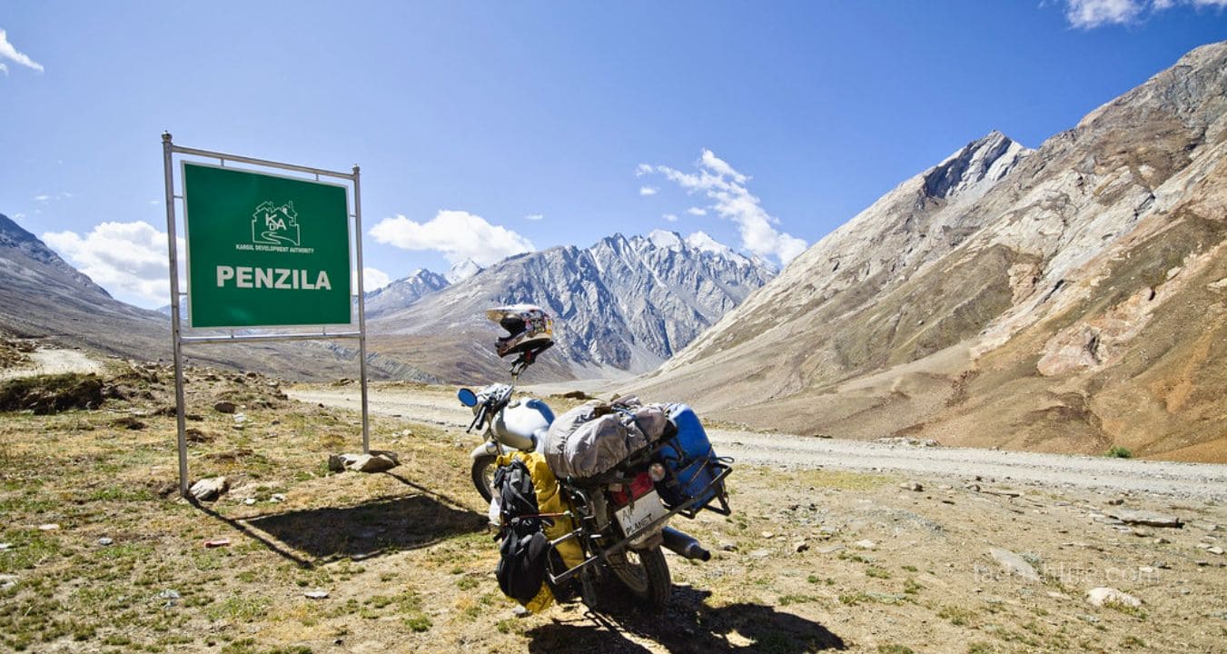
Route: Leh → Karu (35 km) → Chang La (another 35 km from Karu) → Tangste → Pangong Tso.
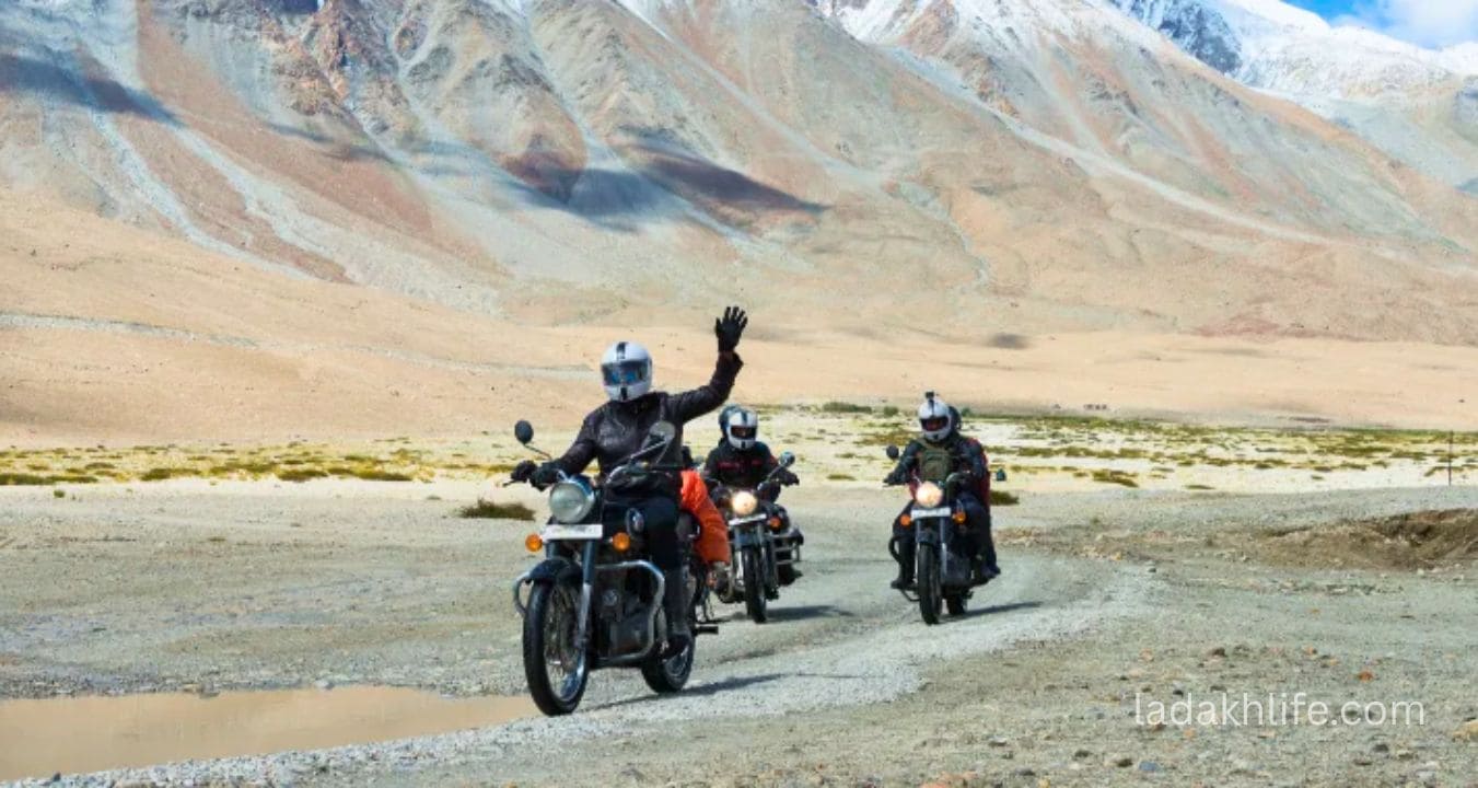
By bike: The classic Ladakh experience. Your bike will struggle with the thin air expect reduced power, especially on steep sections. Keep the revs high and downshift early. And wear all your gear it's freezing at the top.
By car (4x4 recommended): A regular car can do it, but a 4x4 handles the rough sections better. The road is paved most of the way, but there are patches of gravel and potholes. Take it slow.
By taxi: Most travelers hire a taxi from Leh for the round trip to Pangong Tso, which includes crossing Chang La. Expect to pay ₹8,000-12,000 for a 2-day trip (Leh → Pangong → Leh).
By bus: There are no direct buses from Leh to Pangong that cross Chang La. The only way is by private vehicle or shared taxi.
Altitude, Fitness, and Acclimatization (Read This Twice)
17,590 feet is no joke. The air at the top has about 50% of the oxygen at sea level. Altitude sickness is common, even if you've never had it before.
- Spend at least 2-3 days in Leh (11,500 ft) before attempting Chang La. This is non-negotiable. Do not go on day 1 or day 2.
- Drink 4-5 liters of water the day before and the day of. Hydration helps prevent AMS.
- Limit your time at the top. 20-30 minutes maximum. The longer you stay, the worse you'll feel.
- Descend immediately if you feel severely unwell. Headache, nausea, dizziness, shortness of breath if it's bad, go down. Don't be stubborn.
- Carry Diamox if you're prone to altitude sickness. Consult your doctor before the trip.
- No alcohol the night before. No heavy meals. No smoking.
I've seen people turn back at Chang La because the altitude was too much. I've seen people vomit at the top. Don't let that be you. Respect the altitude.
What to Pack for Chang La
Even in summer, the top is freezing. Here's what you need:
- Warm layers: Thermal innerwear, fleece sweater, down jacket or heavy woolen sweater, windproof outer layer. Yes, all of them.
- Gloves: Thick winter gloves. Your fingers will go numb without them.
- Headwear: Woolen beanie or balaclava. The wind is brutal.
- Scarf or buff: For your face.
- Shoes: Sturdy shoes or boots. It can be snowy and slippery.
- Sunglasses: Essential. The snow glare at high altitude is intense.
- Sunscreen & lip balm: The UV at 17,000 feet is extreme. You will burn.
- Water & snacks: The army cafe gives free chai, but carry your own water and energy bars.
- Power bank: Your phone battery will drain faster in the cold.
Essential Tips for Visiting Chang La
- Get permits before you go. Chang La is on the way to Pangong Tso, which is near the border. Indian nationals need an Inner Line Permit (ILP). Foreign nationals need a Protected Area Permit (PAP). Arrange these in Leh through a travel agent or at the DC office.
- Start early. Leave Leh by 6 AM at the latest. You have a long drive to Pangong after the pass.
- Check road conditions before you go. Ask at your hotel or at the taxi stand. The pass can close due to snow even in summer.
- Fill your fuel tank in Leh. There's no petrol station at Chang La. The next reliable fuel is back in Leh.
- Respect the army presence. Don't take photos of checkposts, bunkers, or soldiers. Be polite, show your permits, and move on.
- Don't litter. Carry your waste back to Leh. There's no garbage collection at 17,000 feet.
- Visit the temple. It's small, it's quiet, and it's worth five minutes of your time.
- Drink the free chai. It's not just tea. It's kindness at altitude. Say thank you.
Chang La vs Other High Passes in Ladakh
- Chang La vs Khardung La (18,380 ft): Khardung La is higher and more famous. Chang La has a temple and free chai. Both are incredible. Do both if you have time.
- Chang La vs Umling La (19,300 ft): Umling La is the highest, but it's remote and has no facilities. Chang La is more accessible and has the army cafe and temple.
- Chang La vs Fotu La (13,479 ft): Fotu La is on the Leh-Srinagar highway. It's lower and less dramatic. Chang La is the real high-altitude experience.
Why Chang La Deserves More Love
Let me be honest. Khardung La gets all the attention. The posters. The Instagram posts. The "I survived Khardung La" t-shirts. Chang La sits quietly in its shadow, asking for nothing, offering everything.
But here's the thing. When you're standing at Chang La, with the wind in your face and the prayer flags whipping above you, you won't care about the fame. You'll care about the chai. The temple. The kindness of the soldiers. The view of the Chang Chenmo range.
Chang La is not the highest. It's not the most famous. But it might be the most soulful. And sometimes, that's better.
So when you drive from Leh to Pangong, don't rush Chang La. Stop. Walk around the temple. Drink the free chai. Talk to the soldiers. Stand at the edge and look at the mountains. And when you finally descend toward Pangong, you'll carry a little bit of Chang La with you.
Chang La won't give you the highest altitude or the biggest bragging rights. But it will give you something rarer a moment of peace at 17,000 feet, a cup of free chai from a soldier who understands the cold, and a quiet sense that you're exactly where you're supposed to be. That's Chang La. That's enough.